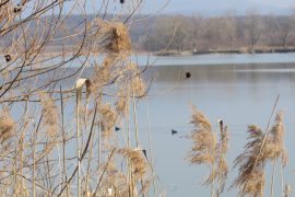
The Batar cross-border polder system is located in Zatsyatschyna in the riverside of the Tisza and Tour rivers. The basis of this drainage system is the channeled with the Batar River.
The Botar River dates back to the northwest in the slopes of the Avash mountains in the upper reaches near the village. Novoselytsya (Vynohradiv district) near the village of Vilok flows into the river Tisa. Length of the river is 53 km. The area of the Botar River basin is 345 km2. When entering the plain, the river, except the lower part, is almost completely subjected to sewage, in particular, to the north-west. On the outskirts of the village, the dune from the river originates from the New Botar Canal, which is located in the north-west in which the Peterfolvo runs into the Tisa. However, at the bottom, on the shade offered for reservation, the site of the river Botar is preserved in its natural state, with characteristic meanders of the channel and a small, limited dam, floodplain. In the floodplain are preserved wetlands, floodplains, small old water reservoirs and reservoirs of artificial origin – kopanka. The latter are located mainly at the foot of the dam embankment. In summer, the river bed in the lowlands dry up during the period of boundaries, turning into a cascade of disconnected small ponds, which in some years can also almost completely dry up. Today, it is probably the only and last section of the preserved natural channel of the small river and its floodplain complex in the whole plains of Transcarpathia.
In 1960-1980 most of the open grid (canals), hydrotechnical structures, 6 inter-farm and several in-house pumping stations were built in Ukraine to supply water for irrigation of agricultural land. The system covers an area of 19.6 thousand hectares, the area of drainage conducted by potable drainage of the bilateral regulation – 15.3 thousand hectares. According to the hydrogeological-reclamation monitoring program and complex of works on hydrogeological, engineering-geological, hydrochemical, soil-chemical indicators are carried out on the system in order to ensure the rational use of land and water resources, as well as identify the causes of their unsatisfactory status, and timely execution of measuring water, preservation of soil fertility, protection of water and land from pollution.
Project area: Vynohradivskyi district, Zasytishchyna – the territory of the Batar cross-border polder system.
Objective: Integrated use of water in the Batarsk drainage system and protection of the population against floods.
Results:
- The feasibility study of the reconstruction of the Batar system has been developed.
- Automated monitoring system of AISS “Tisa” expanded.
- Assessment of agriculture and ecological status of water bodies in accordance with the EU Water Framework Directive.
- The biodiversity of the Botar River valley has been investigated. According to the results of the research, the scientific monograph, “Biodiversity of the Tisza-Tour inter region: assessment of the current state and conservation measures” was published.
- A botanical reserve of local importance Botar (277.1 hectares) and a botanical reserve of local importance Holmovets Mountains (290 hectares) were created.
- Proposals have been submitted to the Ministry of Ecology and Natural Resources for the creation of the Emerald Network of Ukraine facility in the Botar River (part of the natural floodplain, 3 most recent results achieved by the Ecosphere R&D).
Project partners: ENPI CBC – HUSKROUA (2007-2013), Tisza BWR, Institute of Hydrobiology of the NAS of Ukraine (Kyiv), Upper-Tiszai Water Affairs Directorate (Hungary), Somesh-Tisza Water Management of the National Water Authority of Romania, Vynohradiv RDA , Vynohradiv interregional water management department, State Transcarpathian Center of Regional State Fertility. The associated partner of the project is SE “Joint Directorate of Construction of Water Management Facilities of Transcarpathian Region”.


